• Jumolhari Trek

Jumolhari Trek

Trip Overview

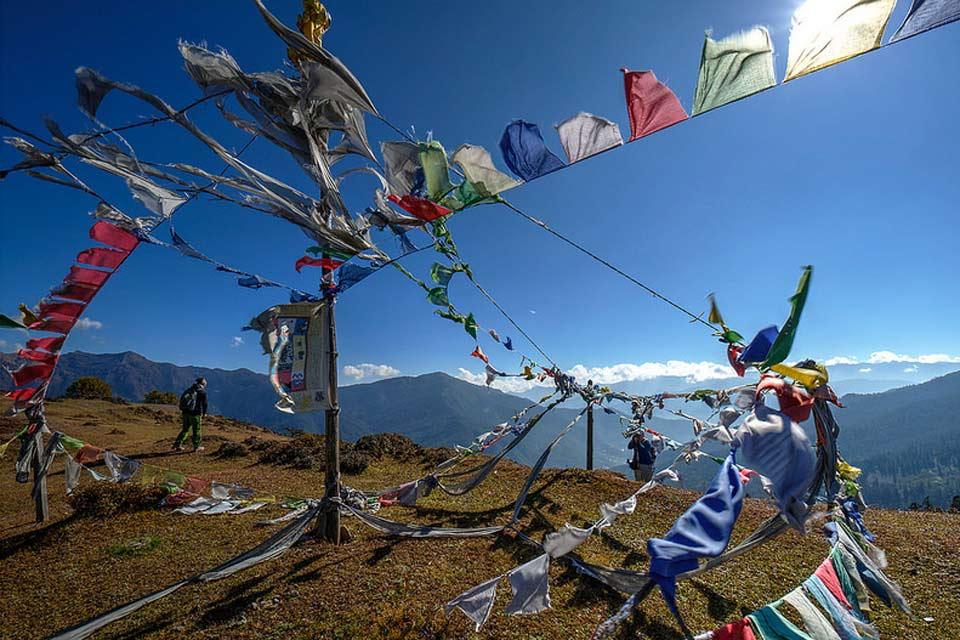
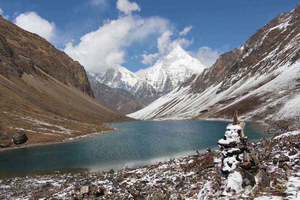
Jumolhari is the second highest unclimbed peak in the world. The trail takes you through high pastures which are used by yak herders as grazing land for their  their animals. As you trek you will also come across Lingzhi, the highest settlement in the north with a unique mountain culture. En route you will have spectacular views of Mount Jichu Drake (6989m) and Tshrim Gang (6789m).

Itinerary


Day 01: Arrive Paro

The flight into Paro on national carrier, Druk Air, is a befitting introduction to the spectacular beauty of our country. In clear weather, magnificent views of the world's highest peaks, give way to the lush green Paro valley as you land. On arrival at Paro international airport, you will be received by our representative and will escort you to hotel. In the after noon visit is Ta Dzong, an ancient watchtower, which now houses the National Museum. Below the museum is the Paro Rimpung Dzong, the centre of civil and religious authority in this valley. A short walk takes you to the base of the dzong and across a traditional cantilevered, covered bridge. A short distance further is one of the innumerable archery grounds. (Archery is the national sport of Bhutan). If we are lucky, we may catch a match in action.

  Hotel

  Lunch, Dinner

Day 02: Hike to Taksang (Tiger Nest) then Paro valley sightseeing

Right after the breakfast drive towards the road point to Taktshang. Taktshang Monastery, the most famous of Bhutan's monasteries. Taktshang means "Tiger's Nest," so named because Guru Rimpoche reportedly flew to the site of the monastery on the back of a flying tiger in the late centuries of the first millennium. The monastery is perched on a cliff nearly 3,000 ft above the Paro valley floor. This day hike is not only historically and culturally interesting, but also incredibly scenic! It takes about two hours to reach the cafeteria, which gives a breathtaking view of the Tiger’s Nest. If you still feel like hiking then you can take another hour to reach the temple. Then return back to hotel and free evening.

  Breakfast, Lunch, Dinner

Day 03: Drukgyel Dzong(Paro) - Shana

Starting form Drukgyel Dzong, the fortress that once guarded Paro Valley against Tibetan inviders, the first day is a pleasant walk following the left side of the Pachu River. The farm road serves as the trek route and passes through a number of very small villages with traditional houses, rice and vegetable fields to left and right of the trail.

After about an hour’s walk, the farm road ends at Mitsizamp. Crossing a bridge to the right side of the river, the trail climbs very gradually for another hour through the trees to Zakhapang (2,600m), where nice lunch break-spot in an open and clean space is found. After lunch the trek continues through blue pine forests, following the river closely. Gunyitsawa army outpost appears not long before the end of the first day’s trek. The campsite at Shana, just beyond, is situated at an altitude of 2,820m in a beautiful open space surrounded by blue pine forest. Two traditional houses on the other side of the wide, fast-flowing river make up Shana village.

  Breakfast, Lunch, Dinner

Day 04: Shana-Soi Thangthangka

This is the longest trekking day, taking eight hours to reach the campsite. The trail continues to follow the river gradually ascending through a mixed forest of blue pine and oak and, later in the afternoon, tall rhododendron trees, birch, fir and maple. Though the trail is rocky and bumpy path, it is not strenuous but in rainy conditions it can be quite muddy. There are several simple wooden bridges to cross and sometimes the river reaches right up to the trail. The lunch break comes after about 4 hours of walking through an ever-narrowing valley: Shing Karap or Thombuzam are popular stopping places at around 3,305m.

Several trails leads in other directions, such as the trail to Tremo la, which was the old salt-trading route to Tibet. Not long before reaching the campsite the trail leads you up a ridge with a chorten. Beyond, in the distance, at the end of the valley the Jumolhari Mountain comes into view. Finally, after an 8 hours walk, you reach the campsite.

The camp site is located in spacious clearing and directly faces Mount Jumolhari. The view of early morning sun striking the tip of Jumolhari is breathtaking. Mount Jumolhari, at 7326, is among the world’s highest mountains.

  Breakfast, Lunch, Dinner

Day 05: Soi-Thangthangka - Janmgothang

The third day’s trek is a short one so it is possible to set off a little later and progress at a leisurely pace. When you reach the army outpost you are required to stop and register your entry permits issued by the army headquarters in Thimphu. This matter will be taken care of by your guide.

The Pachu River is again to the right and the trail passes through some very small villages. It will take less then four hours to reach Jangothang, Base Camp. The altitude at the base camp is 4,000m and is a beautiful place to spend the night. The imposing, rounded bulk of the Jumolhari Mountain fills the view to the Northeast and in the evening the profile of the ruined Jangothang Dzong, populated by huge ravens creates a mystical atmosphere. The area is rich in bird life. Birds sighted en route include the Fire-tailed Sunbird, Ibisbill, White throated Dipper, Yellow-billed Chough, Rosy Pipit, Snow Pigeon, Blue-fronted Redstart, Plumbeous Water Redstart, Blood Pheasant, Snow Partridge and many more.

  Breakfast, Lunch, Dinner

Day 06: Jangothang - Lingshi

As you climb steeply above the base camp and into an area of glacial moraine, the views of Jichu Drakey and Jomolhari change along with your perspective. As steep and steady climb, sometimes through snow, brings you to the Nylie-La pass at 4890m. From the top of the windy pass enjoy the 380 degree view. Tshering Gang (6,789) also comes into full view. A fairly tough trek over scree or snow leads down to the valley and then follows the side of a ridge towards the impressively situated Lingshi Dzong (4,370m). The camp site is some distance below?the Dzong on a flat area near a community building made of stones, at an altitude of 4000m.

  Breakfast, Lunch, Dinner

Day 07: Lingshi - Shodu

The trail to Shodu starts with a climb towards a chorten on a ridge opposite the camp and into the Mo-chu valley. After crossing the river theascent towards the Yele-La (4,950m) begins. It take 2 to 3 hours to reach the pass from where there are views of the snowy peaks of Jumolhari, Gang-Chenta, Tshering-Gang and Masang-Gang. In places the paths are sometimes quite narrow and cut into the rock face. At Jimenameshing there are many large boulders and switchbacks. Many find this route quite difficult because of the rocks, boulders and pebbles.  After a tiring day’s ascent, the descent to the camp site in a meadow at Shodu (3,815m) is quite short. Since this is the mail trail to Thimphu, you many meet other Bhutanese travelers en route or at the camp.

  Breakfast, Lunch, Dinner

Day 08: Shodu - Barshong

The River that you are now following is the Thimphu Chu and you will stick closely to the river all day, criss-crossing back and forth over log bridges and passing through an area with steep rock faces and beautiful waterfalls. After crossing to the left bank the trail then ascends towards the ruins of Barshong Dzong (3720). The campsite is here but, since it is quite muddy and steep, another campsite called Domshisa, 1 to 1 ½ hours further down, near a river, is a popular option.

  Breakfast, Lunch, Dinner

Day 09: Barshong- Dolam Kencho

The trail starts with a gentle descent and passes through a dense forest of rhododendron, birch and conifer trees. It then gets quite steep and the trail is very rocky, with many steep cliffs above you. Again you are following the Thimphu-Chu and there are several ridges and streams to cross during the day. At one point the river makes a very sharp turn south. The trail to the right leads you towards the campsite, opening into pasture land as you approach Dolam Kencho (3,428m).

  Breakfast, Lunch, Dinner

Day 10: Dolam Kencho - Thimphu

The final day’s trek is not all downhill but, rather it twists and turns and rises and falls, following the Thimphu-Chu most of the time. At points the river is far below you. After reaching a pass at 3510m the descent then starts towards Dodena. Again, there are some very steep cliffs and beautiful mixed forests of rhododendron, bamboo and conifer. After about 3 hours you emerge at Dodina, and the black tooped road. Then drive back to Thimphu fom Dodena now takes about 45 minutes to 1 hour, past villages and farms.

  Hotel

  Breakfast, Lunch, Dinner

Day 11: Thimphu Sightseeing

The day begins with a visit to the National Memorial Chorten (1974) built in honour of our late King Jigme Dorji Wangchuk and the Dupthop Lhakhang one of the few surviving nunneries in Bhutan. We then visit the National Library, stocked with ancient Buddhist manuscripts, and the Painting School where traditional art is still kept alive through instructions in the art of painting Thangkas (sacred Buddhist religious scrolls). After Lunch, visit the Handicrafts Emporium followed by shopping for souvenirs in the shops of Thimphu. In the evening, visit to the Tashichho Dzong, seat of the national government and the Central Monastic Body, including the summer residence of the Je Khenpo (Chief Abbot of Bhutan).

  Hotel

  Breakfast, Lunch, Dinner

Day 12: Final departure.

Transfer to the Paro Airport for your departure to next destination.

  Breakfast

12 days

Trip at a Glance

  •    Country: Bhutan
  •    Trip grade: Moderate to Hard
  •    Activities: Trekking
  •    Meals: Full Board (B,L,D)

Similar Trip

Bhutan Druk Path Trek
10 Days 9 Nights